
Philipsburg, St. Maarten: Town Layout, History and Landmarks
Philipsburg is the town between Great Bay and the Great Salt Pond on the Dutch side of St. Maarten. Its waterfront, shopping streets and historic center sit close together, which makes the town easier to understand once you know the order: bay and beach, Boardwalk, Front Street, Back Street, then the roads by the pond. This guide focuses on the town itself; the Philipsburg Boardwalk Visitor Guide covers a longer waterfront visit.
At a glance
- Where: On a narrow strip of land between Great Bay and the Great Salt Pond.
- Town layout: The Boardwalk follows the bay; Front Street and Back Street run inland, roughly parallel to the waterfront.
- Useful central landmarks: The Courthouse on Front Street, Wathey Square and Captain Hodge Wharf toward the bay.
- Why it matters: The old street plan reflects Philipsburg’s former salt trade as well as its present-day role as St. Maarten’s capital.
- For a short look: Start in the central waterfront area, use the Courthouse as a town landmark and choose whether to continue toward the beach or farther along Front Street.
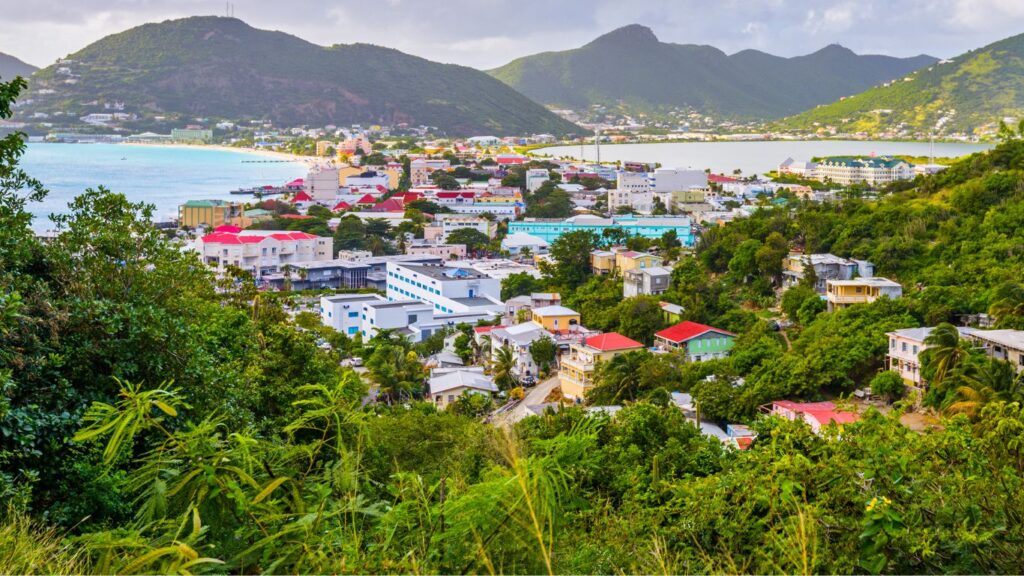
How Philipsburg fits between the bay and the pond
Great Bay forms the southern edge of the town. The beach and promenade run beside it, while Front Street lies just inland. Back Street runs behind Front Street; farther inland, Pondfill Road follows the side of town facing the Great Salt Pond. The short cross streets are what make the town feel connected: a visitor can move between a waterfront view and the commercial streets without making a separate trip across the island.
This arrangement also helps distinguish the places visitors often group together. Great Bay Beach is the sand and shoreline. The Boardwalk is the seaside promenade beside it. Front Street and Back Street are town streets, with shops and other businesses.
Front Street and Back Street are the town’s main shopping streets. Browse the shopping listings for places along and near them.
Why the streets were built here
Philipsburg’s location is tied to salt. A St. Maarten government planning document records a 1733 decision to establish a village on the strip between Great Bay and the salt pond. Its account describes one axis running from the pond through the Courthouse area toward the bay, reflecting the movement of salt, and a second axis along Front Street. The town’s shape therefore tells part of its economic history before any monument does.
Salt production at the Great Salt Pond continued into the twentieth century and ended in 1949, according to a government agriculture policy. Land was later reclaimed from the pond in the early 1970s for the area known as Pondfill. The present road and built-up inland edge are another chapter in the same story: Philipsburg grew outward from its older street grid while retaining the bay and pond as its two defining edges.
Landmarks that help you find your way
The Courthouse on Front Street is a useful central reference point. Near it, Wathey Square opens toward Captain Hodge Wharf and Great Bay. This is a practical place to understand the town’s direction: the water is on one side, Front Street is inland, and the Boardwalk continues along the bay.
Farther along the western waterfront, Walter Plantz Square brings traditional-style building details into a modern public square. It is a short architectural and historical stop, rather than a separate full-day attraction. Its own guide explains the fountain, buildings and the person behind the name.
The Great Salt Pond is not a beach stop, but it deserves a place in a Philipsburg visit because it explains why the town developed here. When you move inland toward Pondfill Road, you are moving toward the former salt-working side of the settlement. The town’s waterfront and its inland edge have different stories; seeing both gives Philipsburg more meaning than a beach-and-shopping description alone.
Where to go next in Philipsburg
Choose a direction from the central town area. For a waterfront walk, follow the Boardwalk Visitor Guide for landmarks, time plans and the connection with Great Bay. If you want the beach to be the main part of your visit, start with the Great Bay Beach guide. Front Street and Back Street suit a town-focused look; the shopping directory helps you browse places without relying on an undated list of recommended stores.
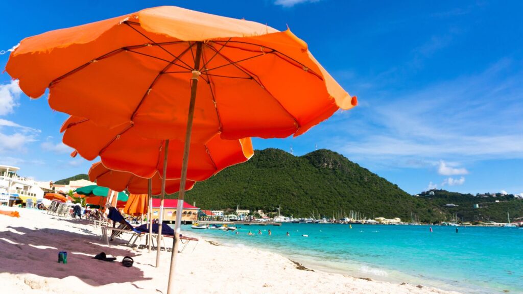
Cruise visitors can walk into Philipsburg, use a water taxi or take a road taxi. Port St. Maarten describes the walk into Philipsburg as about 15 minutes; that is not a measured time from every ship’s gangway to every town landmark. Bobby’s Marina, Walter Williams Jetty and Captain Hodge Wharf are named waterfront water-taxi stops. Choose your arrival and return point before building a town walk around them, and keep your ship’s all-aboard time in view.
Philipsburg is more than the strip of sand beside Great Bay. The relationship between the bay, the commercial streets and the salt pond is what gives the town its shape. Start with that layout, then let the part you came to see determine how far you continue.